


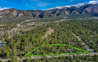
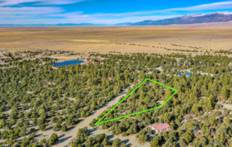
Trees and Mountain Views! Stunning 3.21 Acres in The Zapata (#PID 122)
RESERVE NOW with $250 Deposit
Payment Options
Payment Note(s)
A $250 deposit reserves this property for you today! Cash buyers will pay the balance at closing. Owner Finance Buyers will pay the remainder of the down payment at closing and then set up automatic monthly payments. Your deposit will apply towards the purchase price / down payment / doc prep fee. Just click the “Reserve Now” button above and enter in your credit/debit card information. We will be notified immediately once you make a deposit, and we will contact you to complete the rest of the transaction. If, for whatever reason, you do not end up completing the contract paperwork, your deposit is 100% refundable. There is an additional $250 document preparation fee at closing for this purchase.
Email us at hello@landforgrabs.com for other payment options. We’re flexible and can work with your budget!
Link to Drone Video:
Description
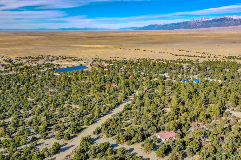
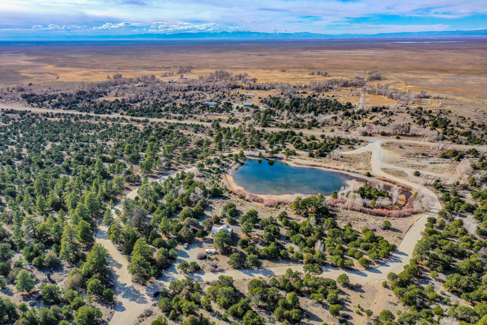
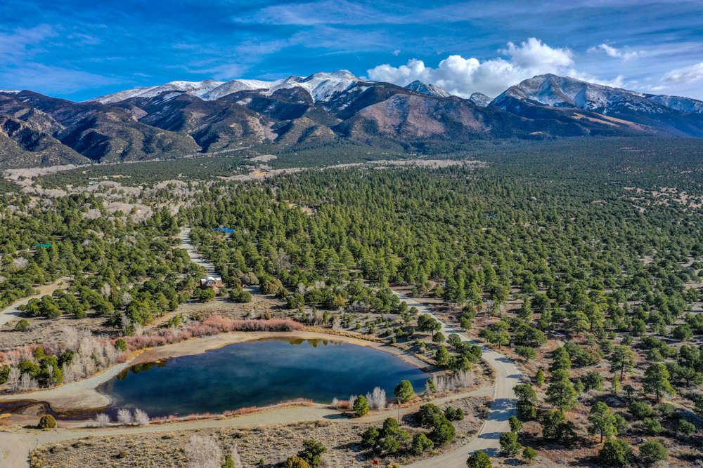
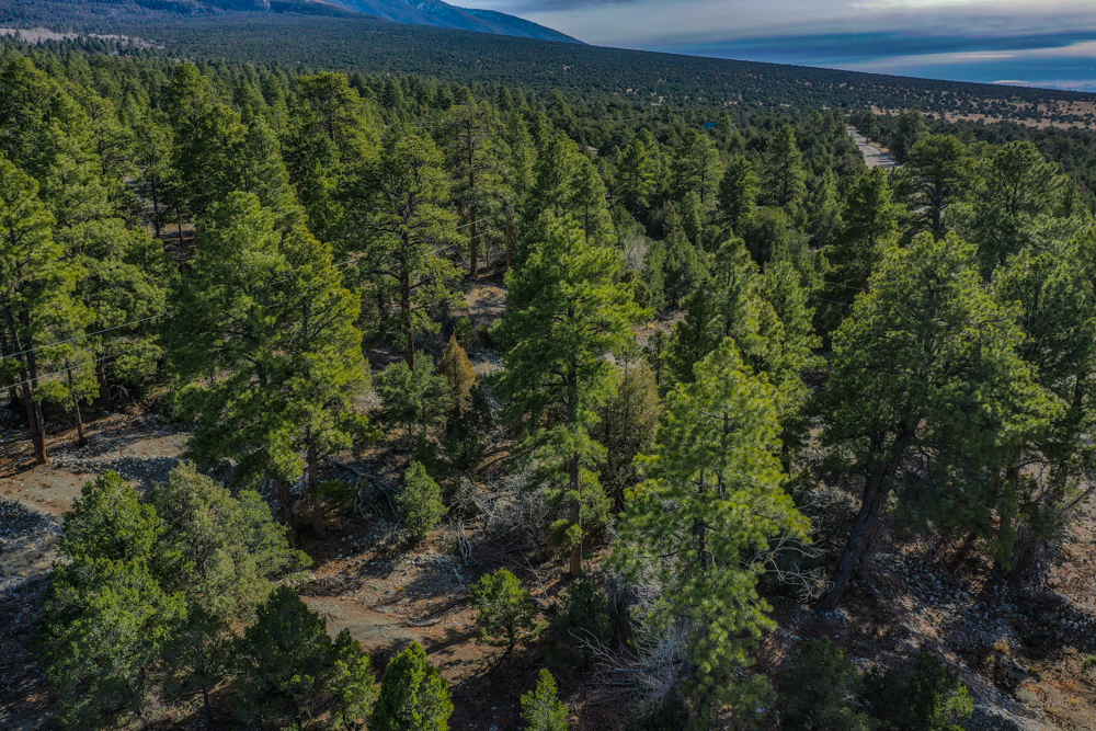
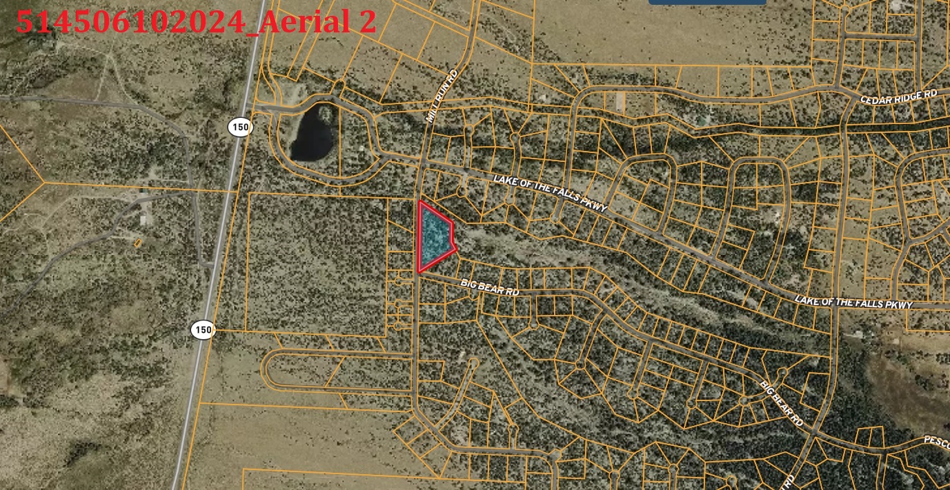
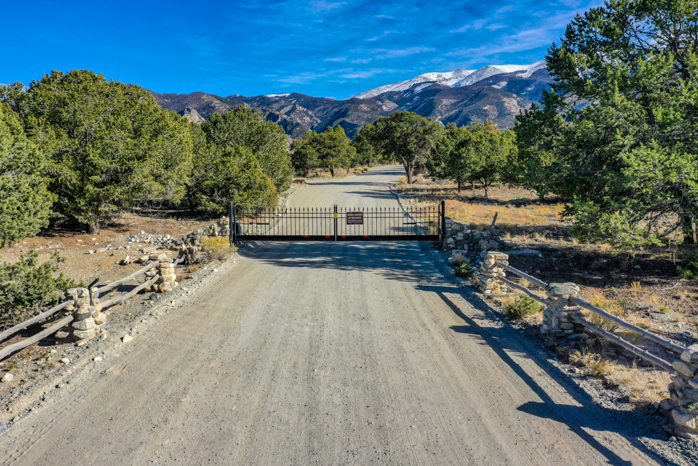
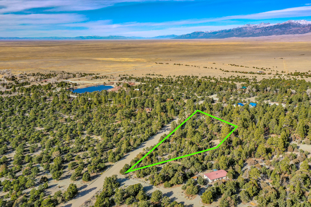
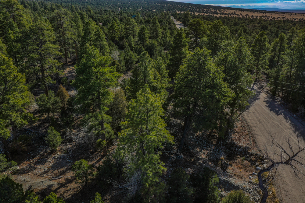
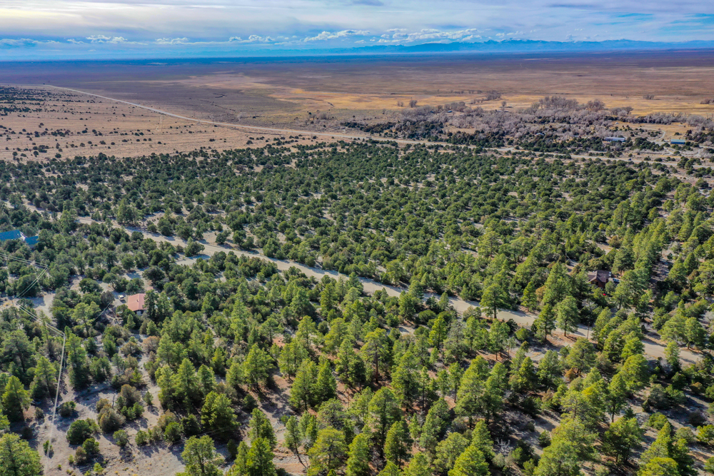
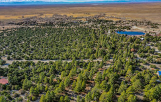
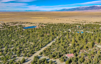
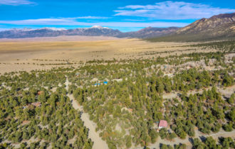
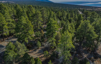
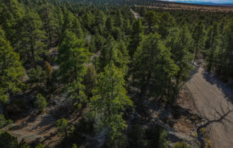
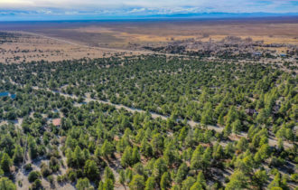
The best of Colorado is waiting for you on this 3.21-acre property in The Zapata subdivision. This property is in a prime location near the subdivision’s entrance and just 1/3 mile from paved Highway 150. Only a few other houses are in the area, and the beautiful mature trees on this lot give you extra privacy. Houses here must be site-built on a concrete foundation, and you can build a guest house and up to a three-car garage as well. This is the best of Colorado country living without sacrificing modern services.
Alamosa is just 27 miles away. This small city of 9,900 residents is the economic center of the San Luis Valley, and you can find almost everything you need here. The city has a few big box stores and lots of local businesses. Adams State University is here, giving the city an overall youthful vibe.
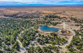
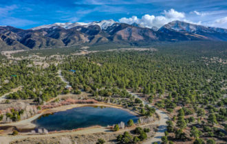
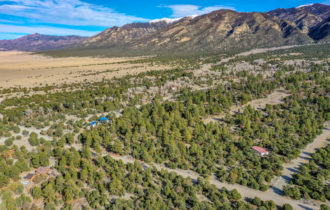
The San Luis Valley is an outdoor lover’s paradise. Great Sand Dunes National Park is only four miles from this property. Spend warm summer days sand sledding or splashing in Medano Creek. This is one of the darkest places in the United States, so bring your telescope for the best views of the night skies. When you want more extreme adventures, lace up your hiking boots, hit the trails, and check some fourteeners off your Colorado Bucket List. Blanca Peak and Mount Lindsey are practically in your backyard!
This property is ideally located just 1/3 mile from Highway 150 in one of Southern Colorado’s most desirable subdivisions, and at this price it will not last long. Contact me today for more information.
Property will be conveyed via Special Warranty Deed.
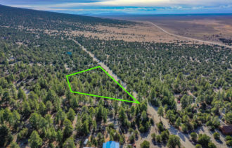
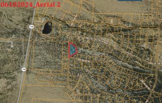
Approx. GPS Coordinates: 37.649468, -105.577268
Approx. GPS Coordinates for the Property Corners:
NW: 37.650419, -105.577677
NE: 37.649858, -105.576646
SW: 37.648618, -105.577709
SE: 37.649181, -105.576535
Google Maps Link: https://goo.gl/maps/drLEwqJ2Mk4bcLhb7
Nearby Attractions:
Great Sand Dunes National Park and Preserve – 4.0 miles via CO-150 S
Zapata Ranch, Mosca, CO – 1.5 miles via Lane 4 9 N
Monte Vista National Wildlife Refuge, Monte Vista, CO – 44.9 miles via Lane 5 N and Lane 6 N
Property Information
Parcel Size
3.21
State
Colorado
County
Alamosa
Nearest Cities
Blanca
Parcel #
514506102024
Legal Description
TRACT 7 (A VACATION OF LOTS 1, 2, AND 3), BLOCK 50, THE ZAPATA, UNIT TWO, ACCORDING TO THE PLAT THEREOF FILED FOR RECORD IN THE OFFICE OF THE CLERK AND RECORDER ON DECEMBER 29, 2000 AT RECEPTION NO. 300290, COUNTY OF ALAMOSA, STATE OF COLORADO.
Features
3.21
Acres
Alamosa
County
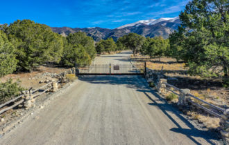
Property can be accessed via Mill Run Rd.
Access
There are power lines near the lot.
Power
Able to drill a well
Water
37.649468, -105.577268
Coordinates
Residential Low
Zoning
2992 Meters
Elevation
Purchase Information/Fees
$5,000
Down Payment / Deposit
$250
Closing & Document Fee
$205.16/year
Annual Taxes
Link to Due Diligence Report: (Zoning, Utilities, What’s Allowed / Not Allowed, ETC.)
https://drive.google.com/file/d/1yVDJ1GtczHXu8xtt52AtQobDgAl5J5mM/view?usp=sharing
Zapata HOA – Link to Documents:
https://www.zapatahomeowners.org/basic-governance
Notes
ACCESS:
Property can be accessed via Mill Run Rd.
TERRAIN:
Property is lightly treed and gently rolling.
DISCLAIMER
Any information provided in this communication is believed to be accurate, but in no way guaranteed. Buyer is responsible for verifying all information with the County as to what can and can’t be done with the property. Buyer will need to work with the County to obtain the proper permits if needed. Buyer will also need to confirm the availability of any utilities needed or serviced on the property. Seller makes no warranties or representations about the land, its condition, or what can be built on the property. If/when you visit any of our properties, you are visiting at your own risk and release DBA Land For Grabs (and anyone associated) from any and all claims or liabilities.
#PID122